
徒步旅行
西雅图附近有哪些风景最美的徒步路线?
Just a short drive from Seattle, you can find hikes with views of waterfalls, snow-capped volcanoes, and old-growth evergreen forests.
Spring and summer offer sunny skies and meadows dotted with wildflowers, while autumn brings bright foliage throughout the region. Below, find some of the best hikes in and near Seattle.
Beginner-Friendly Hikes in or Near Seattle:
Don't want to venture far? These easy, beginner-friendly hikes are either in Seattle or Seattle Southside, the area around Sea-Tac Airport. If you're staying in or near those areas, all of these hikes are under an hour's drive. They're just rugged enough to make you feel like you got out into nature, but close enough that you can head out at a leisurely place and be back at your home or hotel with plenty of time to spare.

得梅因溪步道
The Des Moines Creek Trail is a paved, tree-lined path that runs for about 2 miles one way, from a trailhead in SeaTac to the Puget Sound shoreline. It's accessible from either end, but you'll have different experiences depending on which you choose. Either way, you'll pass a babbling creek where salmon swim in the fall, plenty of leafy trees, and occasional benches for resting. It's a popular family-friendly activity and great for bird-watching.
North entrance: You can either park in a small parking lot or reach the trail via public transit (it's a short walk from the Angle Lake Link light rail station). The walk begins fairly flat before sloping downhill, then taking a sharp right about halfway. After 2 miles, you'll emerge in beautiful Des Moines Beach Park, where you can extend your hike onto the rocky shoreline or the long pier.
South entrance: Alternatively, you can begin at Des Moines Beach Park, where there is a parking lot. Walk back through the meadow to enter the trail from the south. The trail is fairly flat for the first 15 minutes or so, but does transition into a pretty steep (though smooth) uphill walk.
Is the Des Moines Creek Trail kid-friendly? Yes! Little kids or parents with strollers can handle the first part of the walk well, since it's smooth and well-maintained. If you start at the beach, just walk into the trail until it starts to slope upward, then turn around and head back. Near the north entrance is Des Moines Creek Trailhead Park, opened in 2026, which has accessible playground features and picnic shelters.
Want a longer hike? Just turn around at one end and make it into a 4-mile walk.
阿尔基海滩
若想享受完美的初秋漫步,不妨前往西西雅图的 阿尔基海滩公园,这片绵延的海滩从阿尔基角延伸至杜瓦米什角(一座俯瞰埃利奥特湾的地标)。沿着2.5英里的步道前行,普吉特海湾、奥林匹克山脉与西雅图市中心天际线的全景风光将尽收眼底。从杰克布洛克公园启程,绕过锚地公园的岬角,直抵阿尔基角灯塔。
长度:2.5英里
与西雅图南区的距离:14英里
煤溪径
大岭山公园
格兰德里奇公园拥有7英里蜿蜒穿过西部红柏林的景观步道。这片1300英亩的荒野区域位于伊萨夸和萨马米什湖以北,向徒步者、山地自行车手和骑马者开放。步道亮点是一座横跨峡谷溪的40英尺长手工木桥,其精美构造令人叹为观止。
Length: 7 miles of trails
Distance from Seattle Southside: 25 miles
离西雅图不远的远足景观
花岗岩山径
花岗岩山径是斯诺夸尔米山口走廊最热门的登顶路线。尽管这段4.3英里(约6.9公里)的攀登会让小腿肌肉酸痛不已,但沿途360度环绕的雷尼尔山与斯诺夸尔米山口全景,足以让这段3800英尺(约1158米)的攀登之旅物超所值。
Length: 8 miles
Distance from Seattle Southside: 52 miles
普拉特湖步道
斯诺夸尔米山口附近的普拉特湖是这个过渡季节的理想去处,普拉特湖步道可通往垂钓点、攀爬路线及其他徒步小径。这条往返8英里的徒步路线穿越森林,偶尔经过岩石坡地,沿途可欣赏山景、野花草甸和原始森林。
长度:8英里
海拔:2,300英尺
与西雅图南部的距离:52英里
华莱士瀑布
华莱士瀑布坐落在喀斯喀特山脉西侧,由九级壮观瀑布组成,最高处落差达265英尺(约80米)。 往返徒步路线全长5.5英里,探险者将穿越原始针叶林,沿湍急河流前行,沿途尽览壮丽山景与丰富野生动物。虽然瀑布四季皆美,但当地人建议雨天造访——每滴雨水汇入华莱士河,使奔腾的激流更显磅礴壮观。
长度:5.5英里
海拔高度。1,200英尺
与西雅图南区的距离:55英里
矽山

西山是华盛顿州北本德附近西山自然资源保护区内一条艰苦而热门的徒步路线。这条往返约8英里的步道海拔上升约3150英尺。路线始于茂密的针叶林,沿着维护良好的之字形小径持续攀升。行至约3.5英里处,徒步者将从岩石斜坡上获得壮阔的视野,晴朗天气下甚至能远眺雷尼尔山。 最后一段路程抵达山顶下方的高原;经验丰富的登山者可攀爬"干草堆"岩壁,饱览全景风光。
海拔爬升:3,150英尺
距西雅图南区距离:40英里
对于喜欢冒险的人来说,西山的干草堆(Haystack)只需一小段攀爬就能到达山顶,属于中度 2/3 级攀登。
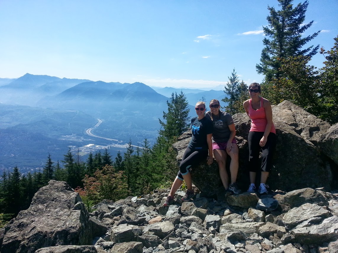
我们坐在阳光下,放松了一会儿,欣赏着广阔的景色,野生动物和一些小吃。在摆了几张照片来记录我们的成就后,我们下山了,为正在前往山顶的徒步者提供我们自己的鼓励。
由于我们在攀登过程中胃口大开,所以我们停在了 北边的酒吧和烧烤店吃汉堡包。这是一家不错的老家餐馆,食物美味,气氛舒适。这里甚至还有一个壁炉和一个巨大的沙发,在寒冷的季节里可以舒适地躺在上面。
长度:4英里
海拔高度。3,700英尺
西雅图南区的距离:40英里
带上你的远足靴、水和可能的雨衣,在冬季阳光消失之前到户外去。
您可能还对以下内容感兴趣...

西雅图南区健身好去处
奔跑、骑行、跳跃、伸展……在西雅图南区,挥汗如雨的方式无穷无尽。

城市骑行。西雅图南区之最
踩下......踏板!骑自行车是一种更环保、更健康的城市出行方式。